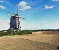
Sary:Steenvoorde, Le Noordmeulen ( PA00107830) (2).jpg

Rakitra niaviana (3 566 × 3 032 teboka, haben'ilay rakitra : 2,72 Mio, endrika MIME : image/jpeg)
Avy amin'i Wikimedia Commons io rakitra io ary mety ampiasain'ny tetikasa hafa. Aseho eo ambany ny famisavisana ilay rakitra.
Ambangovangony
| VisavisaSteenvoorde, Le Noordmeulen ( PA00107830) (2).jpg |
|
||||||||||||||||||||||||||
| Daty | |||||||||||||||||||||||||||
| Loharano | Asan'ny tena | ||||||||||||||||||||||||||
| Mpamorona azy |
creator QS:P170,Q97949455 |
||||||||||||||||||||||||||
| Alalana (Hampiasa ity rakitra ity indray) |
|
||||||||||||||||||||||||||
| Versiona hafa |
 |
||||||||||||||||||||||||||
| Position de l'objet | 50° 48′ 53,91″ N, 2° 34′ 09,74″ E | Voir cet endroit et d’autres images sur : OpenStreetMap |
|---|
Navoaka tambanin'ny lisansy
- Azonao am-palalahana:
- ny mizara – ny mandika, mizara sy manome ity vokatr'asa ity
- ny mamerina – ny manova ity vokatr'asa ity
- Raha manaraka ireo fepetra ireo :
- mahalala ny namorona azy voalohany – Tsy maintsy manome fampahalalana arifomba momba ny mpamorona ianao, manome rohy manondro ny fahazoan'alalana ary raha nisy fiovana natao. Azonao atao amin'izay fomba rehetra azo atao izany zavatra izany, fa tsy amin'ny fomba milaza hoe manohana na manaiky ny fampiasanao an'ilay asa ilay mpamorona.
- zaraina mitovy – Raha manova, mamadika na mifototra amin'ity asa ity ianao dia tsy maintsy mizara ny vokany amin'ny lisansa mitovy na mifandraika amin'ny lisansan'ny asa niaviana.

|
This image was awarded with the 9th prize in the national contest of Frantsa in Wiki Loves Monuments 2019 Other languages:
العربية | беларуская (тарашкевіца) | বাংলা | Deutsch | English | British English | español | فارسی | français | hrvatski | italiano | ქართული | македонски | norsk (bokmål) | norsk (nynorsk) | português do Brasil | русский | slovenščina | svenska | українська | +/− |

|
Ity sary ity dia anisan'ny sary naondrana ho an'ny Wiki Loves Monuments 2019
Afrikaans ∙ Alemannisch ∙ العربية ∙ جازايرية ∙ azərbaycanca ∙ Bikol Central ∙ беларуская ∙ беларуская (тарашкевіца) ∙ български ∙ বাংলা ∙ brezhoneg ∙ bosanski ∙ català ∙ čeština ∙ Cymraeg ∙ dansk ∙ Deutsch ∙ Zazaki ∙ Ελληνικά ∙ English ∙ Esperanto ∙ español ∙ eesti ∙ euskara ∙ فارسی ∙ suomi ∙ français ∙ Frysk ∙ Gaeilge ∙ galego ∙ עברית ∙ हिन्दी ∙ hrvatski ∙ magyar ∙ հայերեն ∙ Bahasa Indonesia ∙ Ido ∙ italiano ∙ 日本語 ∙ ქართული ∙ 한국어 ∙ кыргызча ∙ Lëtzebuergesch ∙ latviešu ∙ Malagasy ∙ македонски ∙ മലയാളം ∙ Bahasa Melayu ∙ Malti ∙ norsk bokmål ∙ नेपाली ∙ Nederlands ∙ norsk nynorsk ∙ norsk ∙ polski ∙ português ∙ português do Brasil ∙ română ∙ русский ∙ sicilianu ∙ davvisámegiella ∙ slovenčina ∙ slovenščina ∙ shqip ∙ српски / srpski ∙ svenska ∙ ไทย ∙ Tagalog ∙ Türkçe ∙ українська ∙ اردو ∙ oʻzbekcha / ўзбекча ∙ Yorùbá ∙ 中文 ∙ 中文(中国大陆) ∙ 中文(简体) ∙ 中文(繁體) ∙ 中文(香港) ∙ 中文(臺灣) ∙ +/− |
 |

|
Cette image a été promue au rang d'image de qualité d'après les critères du Guide des images.
العربية ∙ جازايرية ∙ беларуская ∙ беларуская (тарашкевіца) ∙ български ∙ বাংলা ∙ català ∙ čeština ∙ Cymraeg ∙ Deutsch ∙ Schweizer Hochdeutsch ∙ Zazaki ∙ Ελληνικά ∙ English ∙ Esperanto ∙ español ∙ eesti ∙ euskara ∙ فارسی ∙ suomi ∙ français ∙ galego ∙ עברית ∙ हिन्दी ∙ hrvatski ∙ magyar ∙ հայերեն ∙ Bahasa Indonesia ∙ italiano ∙ 日本語 ∙ Jawa ∙ ქართული ∙ 한국어 ∙ kurdî ∙ Lëtzebuergesch ∙ lietuvių ∙ македонски ∙ മലയാളം ∙ मराठी ∙ Bahasa Melayu ∙ Nederlands ∙ Norfuk / Pitkern ∙ polski ∙ português ∙ português do Brasil ∙ rumantsch ∙ română ∙ русский ∙ sicilianu ∙ slovenčina ∙ slovenščina ∙ shqip ∙ српски / srpski ∙ svenska ∙ தமிழ் ∙ తెలుగు ∙ ไทย ∙ Tagalog ∙ toki pona ∙ Türkçe ∙ українська ∙ vèneto ∙ Tiếng Việt ∙ 中文 ∙ 中文(简体) ∙ 中文(繁體) ∙ +/− |
Légendes
Éléments décrits dans ce fichier
dépeint Frantsay
Valeur sans élément de Wikidata
statut des droits d'auteur Frantsay
sous droit d'auteur Frantsay
26 Aprily 2018
source du fichier Frantsay
pris avec Frantsay
Panasonic Lumix DMC-TZ60 Anglisy
lieu de fabrication Frantsay
coordonnées du lieu représenté Frantsay
50°48'53.906"N, 2°34'9.739"E
participant à Frantsay
Wiki Loves Monuments 2019 Frantsay
durée d'exposition Frantsay
0,002 segondra
nombre d'ouverture Frantsay
3,3
distance focale Frantsay
4,3 millimètre
sensibilité ISO Frantsay
100
type MIME Frantsay
image/jpeg
Tantara ny rakitra
Tsindrio eo amin'ny daty/ora iray mba hijery ny toetra n'ilay rakitra tamin'io fotoana io.
| Daty sy ora | saritapaka | Habe | Mpikambana | resaka | |
|---|---|---|---|---|---|
| ankehitriny | 10 Septambra 2019 à 14:23 |  | 3 566 × 3 032 (2,72 Mio) | Pierre André Leclercq | User created page with UploadWizard |
Fampiasana an'io rakitra io
Tsy misy pejy mampiasa an'ity rakitra ity.
Fampiasan-drakitra maneran-tontolo
Mampiasa ity rakitra ity ireo wiki hafa ireo:
- Fampiasana eo amin'i de.wikipedia.org
- Fampiasana eo amin'i en.wikipedia.org
- Fampiasana eo amin'i fr.wikipedia.org
- Fampiasana eo amin'i meta.wikimedia.org
- Fampiasana eo amin'i nl.wikipedia.org
Metadata
Mirakitra fampahalalana fanampiny, izay inoana ho napetraky ny fakan-tsary na scanner nampiasaina nanaovana ny numérisation-ny ity rakitra ity. Raha kitihina na ovana izy ity dia mety tsy hifanitsy amin'ny sary voaova ireo antsipirihany sasany ireo.
| Mpanamboatra ilay fakan-tsary | Panasonic |
|---|---|
| Karazan'ilay fakan-tsary | DMC-TZ60 |
| Fitaona famakiana | 1/500 s (0,002 s) |
| Isa F | f / 3,3 |
| ISO | 100 |
| Daty fangalana niaviana | 2019-09-10 12:43:10 |
| Halavam-pifantohana | 4,3 mm |
| Laharam-pehintany | 17 056 881° 51′ 12,15″ N |
| Laharan-jarahasina | 17 056 881° 51′ 12,15″ E |
| Halalaka | 4 753 px |
| Haavo | 3 565 px |
| Bit isaky ny singa | 8 |
| Karazana fanakelezana | Tsy nafintina |
| Todika | Tsotra |
| Mpandahatra isaky ny piksely | 3 |
| Famahana mitsivalana | 300 pt/po |
| Isan-teboka mijidina | 300 pt/po |
| Fandaminana ny data | Angona miraibolongana |
| Rindrankajy nampiasaina | Windows Photo Editor 6.3.9600.17418 |
| Daty fanovana | 10 Septambra 2019 à 16:10 |
| Fomba famakiana | Mode paysage (pour des clichés de paysages avec l’arrière-plan net) |
| Versiona EXIF | 2.3 |
| Daty nanaovana numerisation | 26 Aprily 2018 à 16:09 |
| fanitsiana ny fanehoana | 1,66 |
| Fisokafana be indrindra | 3,4453125 APEX (f / 3,3) |
| Fomba fandrefesana | Modely |
| Loharanon-kazavana | Tsy fantatra |
| Tselatra | Tsy nirehitra ny flash, suppression du flash obligatoire |
| Valan-doko | sRGB |
| Fomba tsikariny | Capteur de couleur à une puce |
| Fangon-drakitra | Appareil photo numérique |
| Karazan-tsehatra | Image photographiée directement |
| Fikarakaran-tsary natao manokana | Procédé normal |
| Fomba fiharihariana | Exposition automatique |
| Lanjalanjam-potsy | Balance des blancs automatique |
| Tahan'ny zoom arak'isa | 0 |
| Halavam-pifantohana anaty filma 35 mm | 25 mm |
| Karazam-pandraiketan-tsehatra | Ara-penitra |
| Fifehezan-tsehatra | Tsy misy |
| Fifanoheran-doko | Tsotra |
| Fahafenoan-doko | Tsotra |
| Haranitana | Tsotra |
| Ora GPS (famantaranandro atômika) | 00:00 |
| Toetry ny mpandray | Interopérabilité de la mesure |
| Fomba fandrefesana | Fandrefesana 2D |
| Hatsiko ny fandrefesana | Tena tsara (0) |
| Rafitra jeodezika nampaisaina | WGS-84 |
| Daty GPS | 0000:00:00 |
| Versiônan'ny balizy GPS | 2.3.0.0 |


