
Sary:Gandoman, Iran.jpg

Rakitra niaviana (3 146 × 3 500 teboka, haben'ilay rakitra : 4,47 Mio, endrika MIME : image/jpeg)
Ambangovangony
| Visavisa |
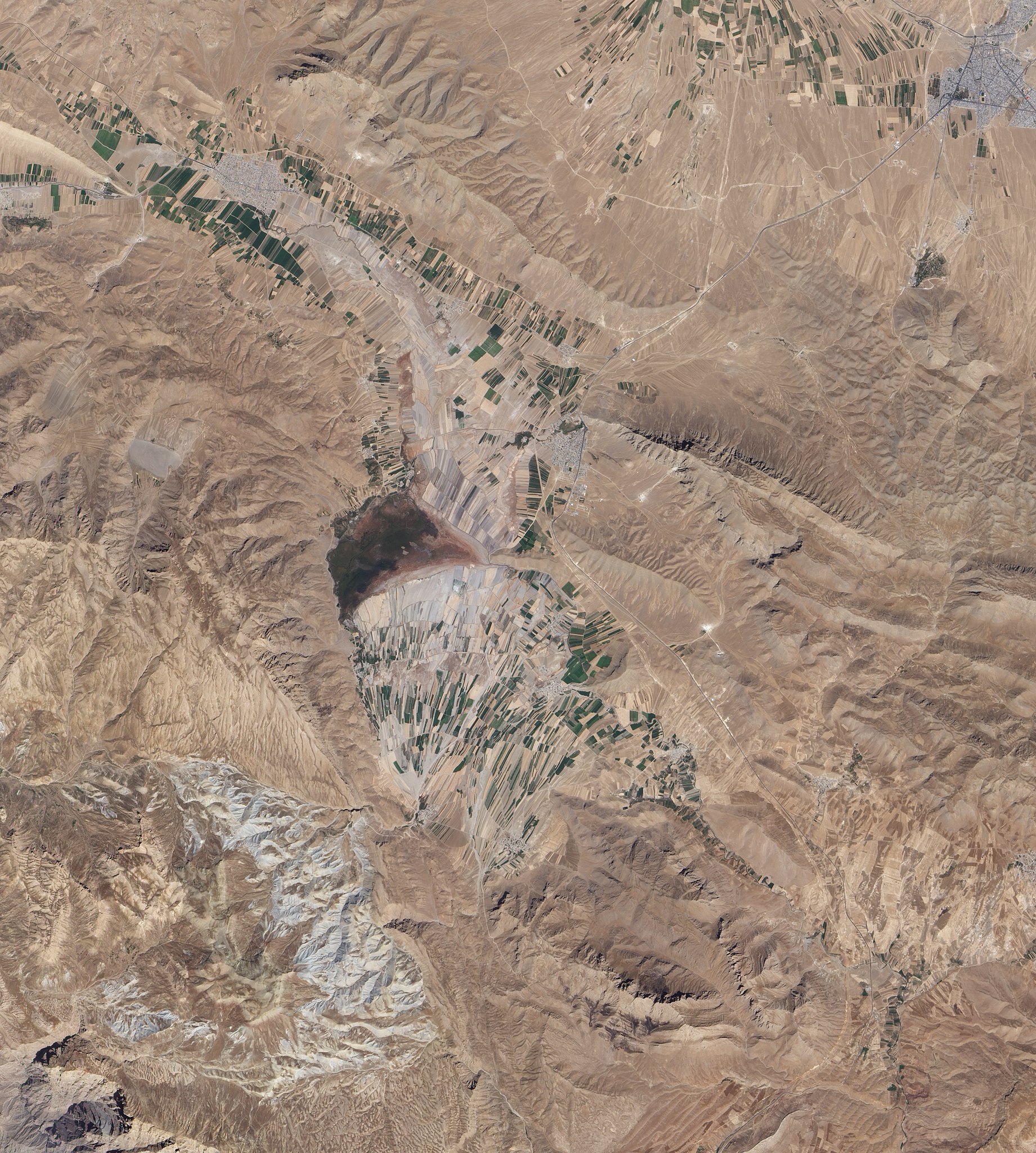
English: Natural-colour image of an area south of Esfahan, including the town of Gandoman. Northwest and south of the city, irrigated fields make elongated rectangles of green, interspersed with earth-toned fallow fields. Crop-lands and settlements are mostly confined to flat areas.
Surrounding the farmed areas are rugged hills and valleys, mostly devoid of vegetation. East north-east of Gandoman, a long ridge casts shadows to the north. It is one of several such ridges visible in this image, and east of the town, the ridges primarily run parallel to each other. In the west, ridge-lines appear more random, extending in multiple directions. Here in the foothills of the Zagros Mountains, elevations are roughly comparable to those of Denver, Colorado, at the base of the foothills of the Rocky Mountains. Near the centre of the image, what might look like a semicircular ridge casting a long, uneven shadow is actually a combination of flat, farmed land bordered on the north by an expanse of natural vegetation. Although water is scarce in this part of Iran, small lakes and wetlands occur sporadically throughout the region. |
| Daty | |
| Loharano | NASA Earth Observatory |
| Mpamorona azy | Jesse Allen and Robert Simmon |
Image captured by the Advanced Land Imager (ALI) on NASA’s Earth Observing-1 (EO-1) satellite.
| Ce fichier provient de la NASA. Sauf exception, les documents créés par la NASA ne sont pas soumis à copyright. Pour plus d'informations, voir la politique de copyright de la NASA. | ||
 |
Attention :
|
| Annotations | This image is annotated: View the annotations at Commons |
Tantara ny rakitra
Tsindrio eo amin'ny daty/ora iray mba hijery ny toetra n'ilay rakitra tamin'io fotoana io.
| Daty sy ora | saritapaka | Habe | Mpikambana | resaka | |
|---|---|---|---|---|---|
| ankehitriny | 1 Novambra 2010 à 11:02 | | 3 146 × 3 500 (4,47 Mio) | Originalwana | {{Information |Description={{en|1=Natural-colour image of an area south of Esfahan, including the town of Gandoman. Northwest and south of the city, irrigated fields make elongated rectangles of green, interspersed with earth-toned [[:Category:Fal |
Fampiasana an'io rakitra io
Mampiasa ity rakitra ity io pejy io:
Fampiasan-drakitra maneran-tontolo
Mampiasa ity rakitra ity ireo wiki hafa ireo:
- Fampiasana eo amin'i ar.wikipedia.org
- Fampiasana eo amin'i az.wikipedia.org
- Fampiasana eo amin'i ceb.wikipedia.org
- Fampiasana eo amin'i en.wikipedia.org
- Fampiasana eo amin'i fa.wikipedia.org
- Fampiasana eo amin'i it.wikipedia.org
- Fampiasana eo amin'i ru.wikipedia.org
- Fampiasana eo amin'i tr.wikipedia.org
- Fampiasana eo amin'i ur.wikipedia.org
- Fampiasana eo amin'i uz.wikipedia.org
- Fampiasana eo amin'i www.wikidata.org
- Fampiasana eo amin'i zh.wikipedia.org