
Sary:EU27-2008 European Union map.svg

Taille de cet aperçu PNG pour ce fichier SVG : 680 × 520 teboka. Habe hafa: 314 × 240 teboka | 628 × 480 teboka | 1 004 × 768 teboka | 1 280 × 979 teboka | 2 560 × 1 958 teboka
Rakitra niaviana (rakitra SVG, habe 680 × 520 teboka, habe : 319 kio)
Ambangovangony
| Visavisa |
Deutsch:
Español:
Français :
Italiano: |
| Daty | (UTC) |
| Loharano | |
| Mpamorona azy |
|
| Versiona hafa |
|


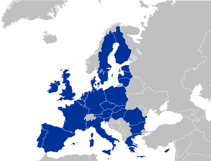
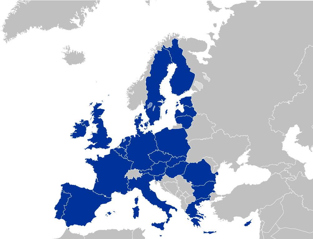
EU-Farbschema / EU color scheme
- Europe blue / Europablau / azul europeo / bleu européenne (Pantone; RGB 003399): EU current members
- Regent St Blue (RAL 6034; RGB 9ac0cd): Transition period (see Brexit withdrawal agreement)
- Pantone yellow / Gelb / amarillo / jaune (Pantone; RGB ffcc00): EU new members
- Light blue / Lichtblau / azul claro / bleu clair (RGB 2782bb): EU candidate countries
- Light green / Lichtgrün / verde claro / vert clair (RGB 77bbbc): EU potential candidate countries
- Lawngreen / Grasgrün / verde hierba / vert pré (RGB a0e200): EU membership possible
- Orange / Orange / anaranjado / orange (RGB ff6600): Eastern Partnership
- Emerald green / Smaragdgrün / verde esmeralda / smaragdin (RAL 6001; RGB 276d3a): EFTA member states
- Pastel green / Weißgrün / verde blanquecino / vert blanc (RAL 6019; RGB b3d9b4): EFTA former member states
Moi, en tant que détenteur des droits d’auteur sur cette œuvre, je la publie sous la licence suivante :
Ce fichier est disponible selon les termes de la licence Creative Commons Attribution – Partage dans les Mêmes Conditions 2.5 Générique
- Azonao am-palalahana:
- ny mizara – ny mandika, mizara sy manome ity vokatr'asa ity
- ny mamerina – ny manova ity vokatr'asa ity
- Raha manaraka ireo fepetra ireo :
- mahalala ny namorona azy voalohany – Tsy maintsy manome fampahalalana arifomba momba ny mpamorona ianao, manome rohy manondro ny fahazoan'alalana ary raha nisy fiovana natao. Azonao atao amin'izay fomba rehetra azo atao izany zavatra izany, fa tsy amin'ny fomba milaza hoe manohana na manaiky ny fampiasanao an'ilay asa ilay mpamorona.
- zaraina mitovy – Raha manova, mamadika na mifototra amin'ity asa ity ianao dia tsy maintsy mizara ny vokany amin'ny lisansa mitovy na mifandraika amin'ny lisansan'ny asa niaviana.
Laogin'ny fampidirana loharano
This image is a derivative work of the following images:
- File:Europe_countries.svg licensed with Cc-by-sa-2.5, Cc-by-sa-2.5/de
- 2009-02-08T23:17:13Z Kolja21 800x520 (564619 Bytes) Rev. Montenegro was deleted
- 2009-02-03T09:39:06Z Koyos 800x520 (548987 Bytes) This map is more accurate, supported by more sources
- 2008-07-24T10:36:24Z Aegean Boy 800x520 (564619 Bytes)
- 2006-05-23T10:51:14Z Tintazul 800x520 (548987 Bytes) {{Tintazul| |Description=Blank map of Europe, showing national borders. SVG format. Includes Kazakhstan. |Date=19 May 2006 }} [[Category:Maps of Europe]]
Téléversé avec derivativeFX
Tantara ny rakitra
Tsindrio eo amin'ny daty/ora iray mba hijery ny toetra n'ilay rakitra tamin'io fotoana io.
| Daty sy ora | saritapaka | Habe | Mpikambana | resaka | |
|---|---|---|---|---|---|
| ankehitriny | 26 Aprily 2010 à 20:36 | | 680 × 520 (319 kio) | Quibik | Fixed some of the lakes not displaying correctly off-wiki. |
| 25 Aprily 2010 à 23:13 |  | 680 × 520 (319 kio) | Quibik | another try... | |
| 25 Aprily 2010 à 23:12 |  | 680 × 520 (319 kio) | Quibik | Trying a RSVG's CSS bug workaround. | |
| 25 Aprily 2010 à 23:09 |  | 680 × 520 (318 kio) | Quibik | Restored the country id-s that went missing with my edit. Also, RSVG displayed the border thicknesses of EU countries wrongly. | |
| 20 Aprily 2010 à 14:30 |  | 680 × 520 (330 kio) | Quibik | optimized the source code | |
| 10 Mey 2009 à 19:39 |  | 680 × 520 (519 kio) | Kolja21 | Minor edit: Grenzverlauf optimiert | |
| 10 Mey 2009 à 00:28 |  | 680 × 520 (518 kio) | Kolja21 | Minor edit: Grenzverlauf optimiert | |
| 4 Mey 2009 à 17:25 |  | 680 × 520 (518 kio) | Kolja21 | Isle of Man (IM; till April 2007: GB-IOM) is not part of the EU | |
| 4 Mey 2009 à 01:10 |  | 680 × 520 (518 kio) | Kolja21 | Malta | |
| 30 Aprily 2009 à 19:14 |  | 680 × 520 (515 kio) | Kolja21 | == Summary == {{Information |Description= {{en|1=European Union (EU 27)}} {{legend|#003399|Current members}} {{de|1=Europäische Union (EU 27)}} {{legend|#003399|Mitgliedstaaten}} {{es|1=Unión Europea (UE 27)}} {{legend|#003399|Estados miembros}} |
Fampiasana an'io rakitra io
Tsy misy pejy mampiasa an'ity rakitra ity.
Fampiasan-drakitra maneran-tontolo
Mampiasa ity rakitra ity ireo wiki hafa ireo:
- Fampiasana eo amin'i de.wikipedia.org
- Fampiasana eo amin'i fr.wikinews.org
- Fampiasana eo amin'i hu.wikipedia.org
- Fampiasana eo amin'i mk.wikipedia.org
- Fampiasana eo amin'i pl.wiktionary.org
- Fampiasana eo amin'i pt.wikipedia.org